Plot watersheds by flow type
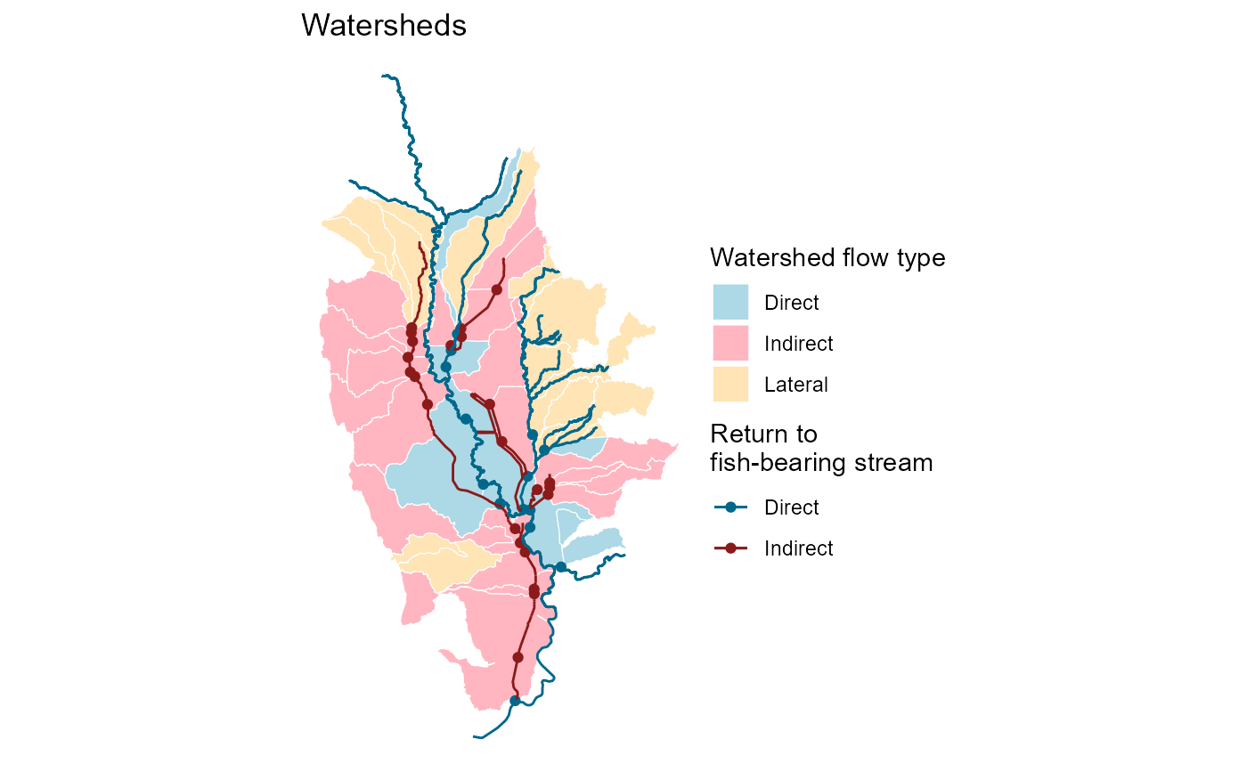
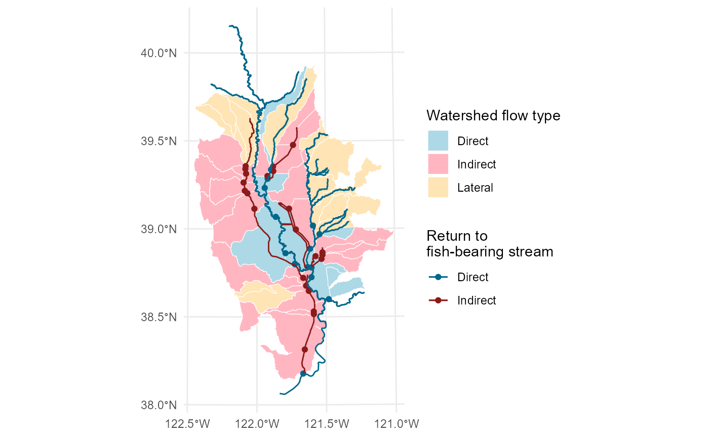
ff_plot_watersheds.RdPlot all watersheds (groups) showing their type of flow: lateral to fish-bearing stream, direct to fish-bearing stream via return point outlet, or indirect to fish-bearing stream via return point outlet and secondary canal. Displays the watersheds, return points, and waterways on the basemap.
ff_plot_watersheds(filename, width = NA, height = NA, units = NULL)Arguments
- filename
File name to create PNG image on disk. Optional if saving the plot is desired.
- width
Plot width in
units. If not supplied, uses the size of current graphics device.- height
Plot height in
units. If not supplied, uses the size of current graphics device.- units
Units used for the width and height ("in", "cm", "mm", or "px"). Uses default
ggplotdpi settings for resolution.
Examples
ff_plot_watersheds()
#> Joining with `by = join_by(return_id, area_ac, volume_af)`

# Returns a ggplot object that can be chained to additional ggplot functions
ff_plot_watersheds() + ggplot2::ggtitle("Watersheds") + ggplot2::theme_void()
#> Joining with `by = join_by(return_id, area_ac, volume_af)`
# Returns a ggplot object that can be chained to additional ggplot functions
ff_plot_watersheds() + ggplot2::ggtitle("Watersheds") + ggplot2::theme_void()
#> Joining with `by = join_by(return_id, area_ac, volume_af)`