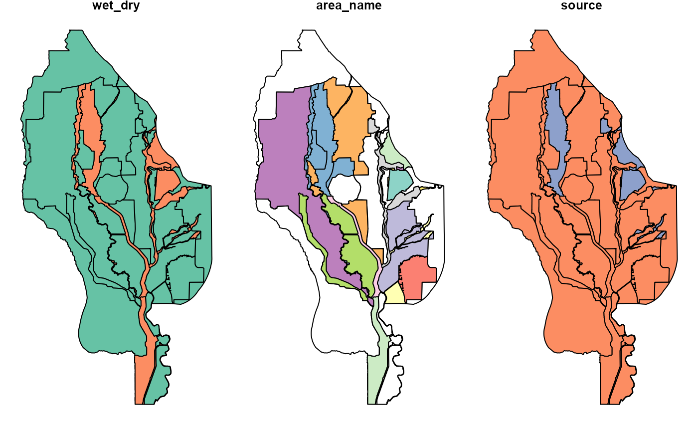
Sacramento Valley wet and dry areas
ff_wetdry.RdThis sf dataset contains polygons identifying which parts of the Sacramento Valley, within the project area, are behind levees ("dry") or directly exposed to rivers or floodways ("wet")
ff_wetdryFormat
An object of class sf (inherits from tbl_df, tbl, data.frame) with 125 rows and 4 columns.
Source
Aidan Kelleher, Bethany Hackenjos, FlowWest, 2023, compiled from data from Ducks Unlimited and others.
Details
wet_dry= identifier of the enclosed area as "wet" or "dry"area_name= name given to the area defined by the polygonsource= source of the polygon and determination of hydrology (wet or dry)
Examples
head(ff_wetdry)
#> Simple feature collection with 6 features and 3 fields
#> Geometry type: POLYGON
#> Dimension:     XY
#> Bounding box:  xmin: 6474596 ymin: 2028968 xmax: 6766993 ymax: 2447911
#> Projected CRS: NAD83(2011) / California zone 2 (ftUS)
#> # A tibble: 6 × 4
#>   wet_dry area_name source                                              geometry
#>   <chr>   <chr>     <chr>                             <POLYGON [US_survey_foot]>
#> 1 Dry     NA        Daniel Fehringer (DU) ((6623854 2379216, 6623853 2379008, 6…
#> 2 Dry     NA        Daniel Fehringer (DU) ((6735708 2143171, 6735731 2143223, 6…
#> 3 Dry     NA        Daniel Fehringer (DU) ((6645812 2284995, 6645847 2285050, 6…
#> 4 Dry     NA        Daniel Fehringer (DU) ((6674774 2180693, 6674794 2180737, 6…
#> 5 Dry     NA        Daniel Fehringer (DU) ((6482270 2236010, 6482264 2236056, 6…
#> 6 Dry     NA        Daniel Fehringer (DU) ((6626920 2234118, 6626914 2234118, 6…

plot(ff_wetdry)